
O Circuit Patagonia Trek — Torres del Paine
O Circuit Patagonia Trek
-
Duration 8 days
-
Difficulty Desafiante
-
Languages English , Spanish
From $2.380.000 / Person
About This Tour
The full loop around the Paine massif in eight days: the remote north side, John Gardner Pass and the Southern Ice Field.
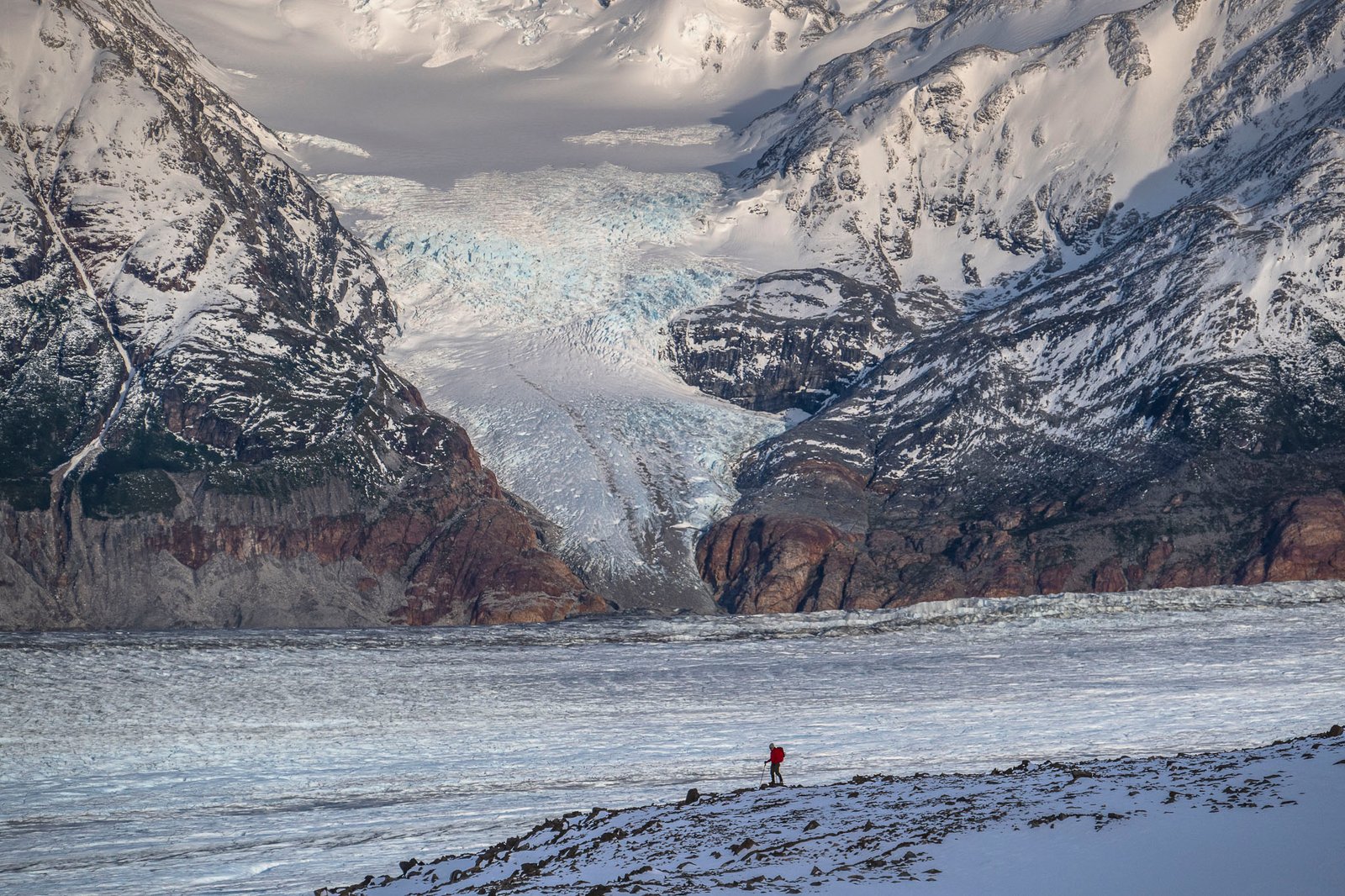
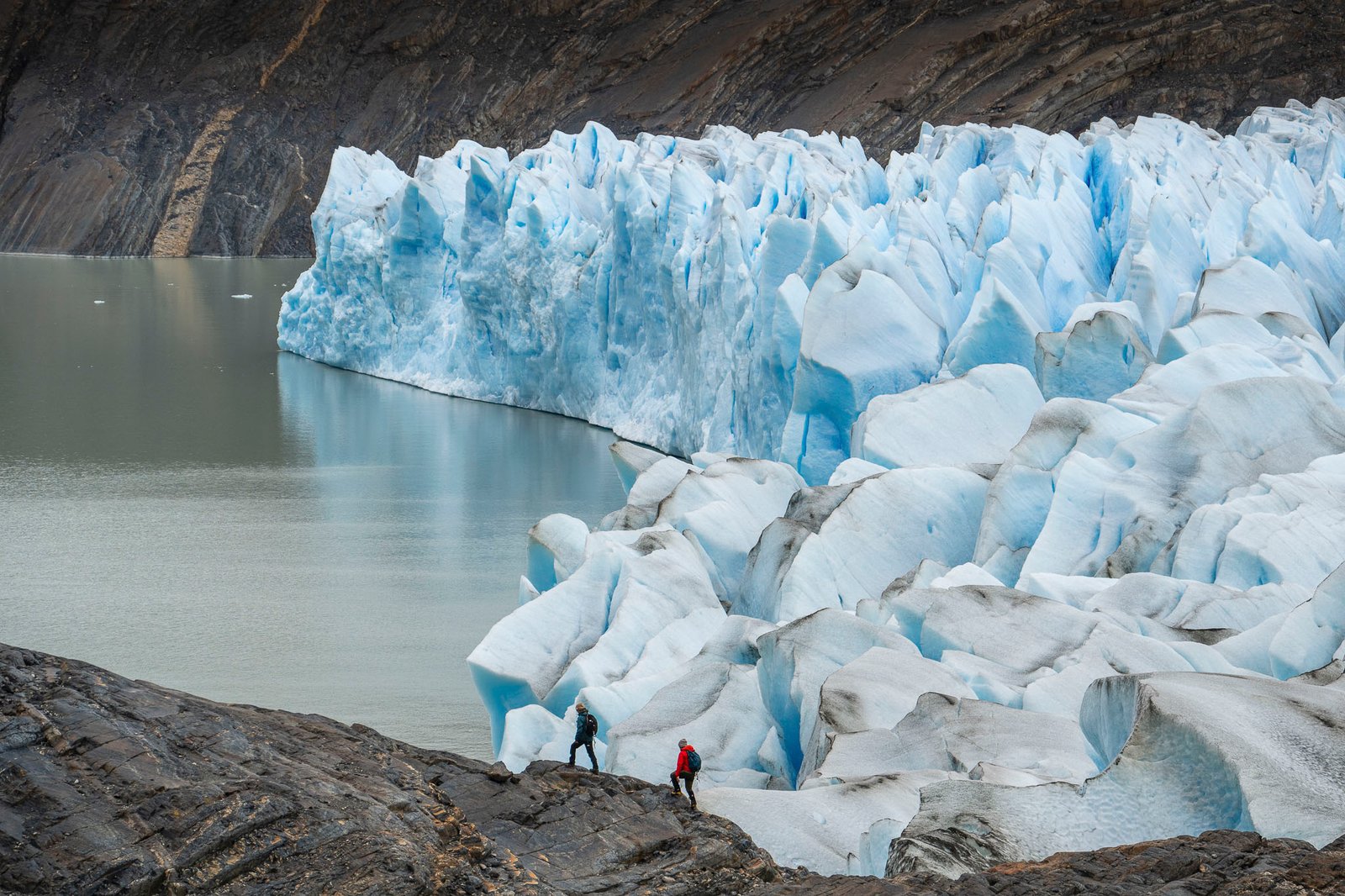
The O Circuit is the ultimate Torres del Paine trek — a full loop around the Paine Massif that reveals the park's wildest, most remote corners. Over 8 self-guided days you'll cover roughly 127 km (78.9 mi) on well-maintained trails, crossing Patagonian steppe, ancient lenga forest, the dramatic John Gardner Pass and the vast Grey Glacier.
What's included
We take care of the logistics so you can focus on the trail: park entrance ticket, round-trip bus transfer from Puerto Natales, and full-board lodging inside the park — nights in the Serón, Dickson, Los Perros, Grey, Paine Grande and Francés sectors, with breakfast, box lunch and dinner each day.
Who it's for
The O Circuit is designed for fit, experienced hikers looking for the complete Torres del Paine experience, away from the crowds of the shorter routes. A guide and luggage porter can be added as extras.
Best time to go
The back section of the circuit opens roughly from November to March, the core Patagonian hiking season. Spaces in the remote refuges sell out early, so we recommend booking well in advance.
New to the region? Start with our guide to things to do in Puerto Natales, or compare it with the shorter W Trek and our other Torres del Paine tours. Ready for Patagonia at its wildest? Reserve your O Circuit with Kali Travels.
Included/Exclude
- Park access ticket
- Bus transfer from Puerto Natales to Torres del Paine (round trip).
- 1 night of lodging in Serón Sector
- 1 night of lodging in Dickson Sector
- 1 night of lodging in Perros Sector
- 1 night of lodging in Grey Sector
- 1 night of lodging in Paine Grande Sector
- 1 night of lodging in Francés or Cuernos Sector
- 1 night lodging in Central or Chileno Sector
- Full board (7 breakfasts, 8 lunches, 7 dinners)
- Breakfast day 1
- Dinner day 8
- Drinks
- Guide (available as an extra)
- Luggage porter (available as an extra)
- Grey Glacier Activities (available as an extra)
Tour Plan
O Trek Itinerary
Difficulty: Medium - low
Distance: 9 mi (14 km)
Total approximate time: 4-5 hours
Positive elevation gain: 951 ft (290 m)
Lodging: Camping Serón
Puerto Natales - Bus Station
On the first day of the tour, you’ll go to Puerto Natales Bus Station and catch the bus going to Torres del Paine at 7:00 am. You’ll be taken to the Laguna Amarga gate, where you’ll first register as a visitor before entering the park.
Welcome Center Torres del Paine
After checking in, take the shuttle bus and in just a few minutes arrive to the Welcome Center of the Cerro Paine Reserve. This is where your route begins! Be prepared to enjoy the spectacular views of Torres del Paine and the Almirante Nieto Massif from there.
Beginning the O Circuit Patagonia
The route is nearly 9 mi (14 km) long and can be divided into three parts: the initial ascent of 820 ft (250 m) over nearly 4 mi (6 km). This section traverses the vast Lenga Forest, a woodland covered in lichens, a plant also known as "old man's beard". When you reach the peak you’ll have views of the valley and the Paine River.
Continue the route downhill for about 2 mi (3 km) until reaching the flatland at the bottom of the valley. This meadow is home to daisies and a herd of wild horses.
Camping Serón
You should finally arrive at the Serón Sector after spending time in the meadow. In this sector the only available accommodations are the premium campsite tents. These tents are assembled before you arrive at the campsite and are fully equipped with the essentials for a good night’s sleep. The campsites have a shower and a communal dining room where meals (dinner and breakfast) are served. Don’t forget to stop at the bar and have a drink to celebrate your first day on the road!
Difficulty: Medium
Distance: 12 mi (18.7 km)
Approximate total time: 6-7 hours
Positive elevation gain: 1,181 ft (360 m)
Lodging: Dickson Sector: premium campsite or lodge
Camping Serón - Paine Lake
Day 2 begins with breakfast at about 8:00 am in the dining room (exact times will be assigned at check-in). Don’t forget to pick up your lunch before leaving! You’ll be hungry at the midpoint of your route.
Today’s portion of the O circuit is divided into two sections. Beginning with a flat 2 mi (3 km) along the Paine River, then accompanied by a stretch of 2.5 mi (4 km) where you’ll climb and descend about 656 ft (200 m) the slopes of Mount Paine adjacent to Lake Paine. At the peak of your hike, you’ll have unspoiled views of Paine Massif and crystal-clear waters typical of glacial lakes.
Lake Paine - Dickson
The second portion of the route consists of flat spaces followed by a few hills. Shortly after descending from the slopes of Cerro Paine, you’ll find a CONAF (park ranger) post and a restroom, (take advantage of it because the WCs are few and far between).
Part two of the route passes close to the Paine River, which is usually a very hot and humid area. This is a good time to put on some insect repellent because it’s the place you’ll most likely encounter mosquitoes. Next, cross a stretch of walkways installed to prevent erosion of wetland areas. Finally, arrive at the Dickson Sector. This sector features a campsite, a lodge with a small dining room, cozy rooms, and very good showers.
Difficulty: Medium-low
Distance: 8 mi (12.5 km)
Total approximate time: 4-5 hours
Positive elevation gain: 1,411 ft (430 m)
Lodging: Los Perros Sector: Campsite
Beginning of the Los Perros Trek
Scarf down breakfast, grab your lunch, and head out for another adventure in Torres del Paine. This is one of the calmest routes of the O circuit, with almost 8 mi (12.5 km) in length and no steep slopes. Little by little, climb to the Los Perros Campsite. After a small initial ascent, you’ll find yourself surrounded by the Lenga Forest (you’ll be crossing the forest for almost the entire route). If you like bird watching, this is the perfect day for you. While in the forest, keep your eyes peeled: the forest is so dense that not much sunlight makes it through to the forest floor, creating a cool and shady environment perfect for countless birds to thrive.
Take it easy and enjoy the tour. Some portions of the route approach the slopes next to the river and feature several viewpoints. This is where many hikers rest and take respite from the mosquitos.
Los Perros Glacier
In the final section of the route, cross a few wooden bridges and climb 330 ft (100 m) up the moraine of the glacial lake until reaching the Los Perros Glacier.
This part of your tour is sure to be a standout. Why? Because, as you climb up the moraine, you won't have a good view of what's ahead of you until you reach the peak. Then, suddenly, you’re gazing at a breathtaking view: a crystal blue lake with a hanging glacier, a truly splendid moment!
Lengas forest
In the forest, you’ll find an endemic bird species of the region, the Magellanic Woodpecker. Throughout the route, take care to spend some time enjoying one of the best locales for observation. The Magellanic Woodpecker can be found in a small clearing in the Lenga Forest, where you can see the glaciers in the surrounding area. You won't regret it!
Camping Los Perros
Almost there! Just a few more minutes of walking and you’re at the Los Perros Campsite. This campsite is located in an area that is very isolated and hard to access therefore, there is no lodge. The showers are cold, while the food is more rustic.
Difficulty: High
Distance: 11 mi (17.2 km)
Approximate total time: 9-10 hours
Positive elevation gain: 2,920 ft (890 m)
Lodging: Grey Sector: campsite or lodge
Southern Ice Field
We recommend starting the day early, this is vouched for by park employees who recommend leaving as early as 8:00 am. With such a long day ahead, it is important to accurately calculate your walking speed so as to arrive at the next campsite at a reasonable time. This is undoubtedly our favorite part but also the most challenging route of the O Torres del Paine Circuit, however, your hard work and dedication will be rewarded.
Today’s route is divided into three parts. Part 1: leave the Lenga Forest and climb to the John Gardner Pass (3.10 mi / 5 km) with a drop of 1,844 ft (562 m) in elevation. Typically hikers traverse snow at the pass, which is why some decide to wear gaiters (a garment to cover hiking boots and pant legs to prevent snow/debris from entering). It is also relatively common to see storm clouds here: keep your raincoat handy.
John Gardner Pass
Step by step, climb to the top of John Gardner Pass. The peak of the pass delivers yet another stunning view: the O Circuit featuring the South Patagonian Ice Field, several glacier tongues, Grey Glacier, and hopefully a rainbow. We only have one word for you: enjoy!
Grey Glacier
Part 2: begins with the descent from Gardner Pass to the trail running close to the glacier. This section is particularly difficult because of both the slope and terrain: stone and aerial roots. The terrain may slow your progress but remember to watch your step! (aerial roots are above ground roots from trees that are easy to trip over)
This stage ends with your arrival at a CONAF camp known as "El Paso" where many travelers take the opportunity to eat a lunch box.
Grey Sector
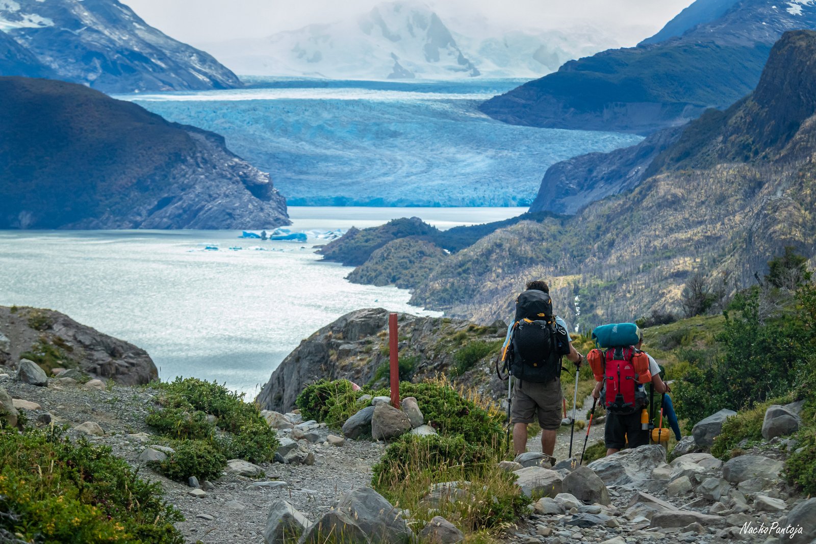
With its reliably spectacular views, Grey Glacier remains on your right as you make your way through Part 3 of this stage of the trek. There's nothing like a leisurely nature stroll, with no slope, good views, and teeming wildlife about. Another great perk of this part of the trek are the three suspension bridges used to cross the Grey Sector. At the refuge, enjoy a drink at the bar or relax on the terrace.
Difficulty: medium-low
Distance: 7 mi (11 km)
Approximate total time: 3-4 hours
Positive elevation gain: 1,083 ft (330 m)
Lodging: Paine Grande Sector: campsite or lodge
Activities on Grey Glacier
As is often the case on the full Torres del Paine circuit, after a tough stage comes an easier one. The route between the Grey and Paine Grande sectors is particularly gentle, giving you plenty of time to enjoy an activity on Grey Glacier. For many travelers, walking with crampons on the glacier ice or kayaking among icebergs is one of the top experiences in Torres del Paine.
These activities take place in the morning, as the hike for that day only takes 3 to 4 hours (1.9 to 2.5 miles), so you’ll have time for everything.
Trekking in the Paine Grande Sector
The route will be short at only 6.83 mi (11 km). Beginning with a flat stretch, it gradually climbs to about 656 ft (200 m) of elevation. Soon, the forest will open up to you, and you’ll begin descending into the Paine Grande Sector.
The visual treat of Paine de Grande is the gift that keeps giving: throughout the day, you'll have incredible views on either side of your trek. On your right, is Lake Grey, accompanied by the diminishing glacier sitting behind it. To your left sits the Paine Massif with the Cerro Paine Grande, peaking at an altitude of over 9,185 ft (2800 m).
Lake Pehoé - Paine Grande Sector
In the last stretch, the trail diverges from Grey Lake and heads downhill towards the Paine Grande Sector. This sector is one of the largest in the park and is located in front of Pehoé Lake. The large, well-equipped refuge features a lively bar.
Difficulty: medium-high
Distance: 14 mi (23 km) to Francés Sector / 17 mi (27 km) to Cuernos Sector
Approximate total time: 8 hours to Francés Sector / 10 hours to Cuernos Sector
Positive vertical drop: 2,625 ft (800 m) to the Francés Sector / 3,215 ft (980 m) to the Cuernos Sector
Lodging: Francés Sector or Cuernos Sector: premium campsite or lodge
To be taken into account
To clarify: there is an optional segment of this route. The portion that ascends to the French or British Viewpoints are optional. You'll have the choice of accessing the viewpoints or going straight to your accommodations, reducing your trek by 8 mi (13 km) from the O Circuit route and avoiding almost all the slope.
However, your assigned accommodations may be in the Francés Sector in Cuernos, which is 2.5 mi (4 km) away from each other. So, let's get started!
Route to Campamento Italiano
This route is divided into three parts. The first part is a 5.6 mi (9 km) segment with almost no slope until reaching a CONAF camp (park rangers) known as the Italian Camp. Before arriving, you’ll reach the intersection leading directly to Francés or Cuernos. At Howlanders, we believe it’s worth the effort to at least climb to the French Viewpoint. If you continue down the trail leading to the viewpoints you’ll arrive at the Italian Camp (Campamento Italiano), where we recommend taking advantage of the nursery and leaving your heavy luggage. Travel light by taking a small pack to carry water, snacks, and something warm.
💬 “Guarderia” The nurseries or guarderias in Torres del Paine are at strategic points along the route and where you can leave your backpack, eliminating the need to carry heavy luggage. Pick up your luggage upon returning from the viewpoints and continue down the same road to continue your day’s trek.
Francés and Britanico lookouts
Part two begins by crossing the French Valley to reach its viewpoint overlooking Mount Paine Grande and its hanging glaciers. Trekkers can expect to walk 1.5 mi (2.5 km) and climb about 984 ft (300 m) of elevation gain in this portion.. If you’re lucky, you might even hear some ice cracking as it breaks off.
This second stage continues with the ascent to the British viewpoint: 2.5 mi (4 km) with a climb of 918 ft (280 m) in elevation gain. At the viewpoint, large boulders crowd together to serve as a lookout to create a 360-degree panoramic view. Take a look at our trek photos, they speak for themselves…
Return to Francés Sector - Cuernos
You’ll start your descent along the same path. When arriving at the Italian Camp, don’t forget to pick up your backpack, and if you haven’t already, stop and have lunch (fellow trekkers will most likely be eating here as well). From the Italian Camp to the Frances Sector expect to continue walking for about 1.55 mi (2.5 km). However, if you’re assigned to the Cuernos Sector, that walk will be 2.5 (4 km) more. Fortunately, this gives you the opportunity to walk along the Lake Nordenskjöld and stroll its beaches.
Accommodations Francés Sector - Cuernos Sector
Francés and Cuernos sectors have the smallest yet coziest accommodations in the park. This is because they are not easily accessible sites. The Chileno Sector is assigned when the Francés Sector is full, especially if traveling in high season. The Chileno Sector also only features a campsite at an additional cost.
Difficulty: medium-low
Distance: 11 mi (17 km) from the Francés Sector / 8 mi (13 km) from the Cuernos Sector
Total approximate time: 6 hours from Francés Sector / 4.5 hours to Cuernos Sector
Positive elevation gain: 1,706 ft (520 m) from Francés Sector / 1,115 ft (340 m) from Cuernos Sector
Lodging: Central Sector: premium campsite or lodge
Francés Sector - Cuernos
As previously mentioned, a hard day of trekking is usually followed by a calm day. So, take it easy on day seven. Today’s route is not too challenging, with a small initial slope of 655 ft (200 m) when leaving the Cuernos Sector.
The remainder of the day is very flat until reaching the small descent leading to the Central Sector. Enjoy the day and the views of the Cuernos del Paine on one side and Lake Nordenskjöld on the other.
Central Sector
When reaching the Central Sector, you’ll notice that both the campsite and refuge are large, similar to the Paine Grande Sector; both sectors serve as entrances to the national park. As a consequence of its centrality, you’ll have the chance to meet many travelers, relax in the large common areas, and of course enjoy one of the liveliest bars on the route.
Difficulty: medium-high
Distance: 14 mi (22 km)
Approximate total time: 9-10 hours
Positive elevation gain: 3,517 ft (1,072 m)
Lodging: not included (return to Puerto Natales)
Ascencio River Valley - Windy Pass
We’ve saved the best for last! Undoubtedly the most popular route in Torres del Paine, this is the route you’ll be trekking on your final day. We’ve divided it into three sections: part one is a 1.25 mi (2 km) walk with a little elevation gain that also crosses the river valley, part two continues for 1.86 mi (3 km) and ascends along a path without the lodge of trees to the Paso de los Vientos and its panoramic views, and part three begins in the Moraine and ends with your return to Puerto Natales.
Lenga Forest - La Morrena
The next 2.48 mi (4 km) will be a segment with very little slope that passes by the Chileno Sector. Little by little you’ll enter the Lenga Forest until reaching the Moraine, an area with large boulders that we would consider the beginning of the third section and the most difficult segment of the day’s hike.
Base Torres Viewpoint
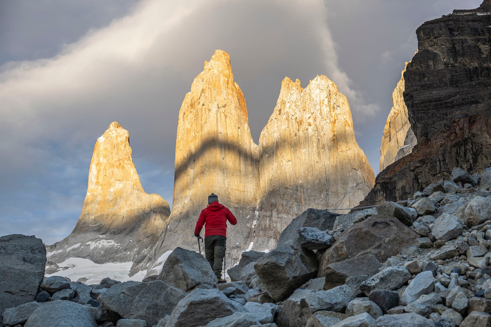
For almost 1.24 mi (2 km) you’ll have to hike uphill around large blocks of rock, a somewhat challenging segment leading to a well-deserved reward: The Base Torres Viewpoint. The viewpoint offers stunning vistas of the glacier lake crowned by the three granite towers that lend the park its name. Relax, take a few pictures, eat lunch with the phenomenal landscape, and of course, enjoy!
Return to Central Sector - Puerto Natales
Start your journey back by walking along the same trail that has led you to the most iconic views of the park. When you arrive at your lodging in Sector Central or Chileno, you’ll collect your backpack and take it to the Welcome Center. Here, board the shuttle bus that will take you back to the park entrance, Portería Laguna Amarga. From there, catch the bus to Puerto Natales around 9:30 pm, thus ending your incredible adventure in the O Circuit Patagonia.